 Those who have read some of my writings on various routing devices are probably aware of my frustration at almost all of these devices being concerned with reaching a point with absolutely no consideration for following a specific path to get there. It’s a sad situation that has only gotten worse. Garmin continues to make models that support this to some degree but they are pricy and, in my opinion, not exactly ideal. A company named River Pilot Tours once offered a turn-by-turn guide to Route 66 (reviewed here) that worked with certain Garmin models but gave it up when compatibility issues appeared with newer Garmin products. MAD Maps once offered a selection of guides that worked with those same Garmin products to provide turn-by-turn directions. When newer Garmin products caused problems, they were dropped and plans announced to replace them with guides for smartphones.
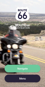
I was kind of excited when Touch Media announced this Route 66 Navigation app in early 2018. Combined with MAD Maps’ smartphone plans, it made me think that I might soon be able to use my phone for the sort of path following that most dedicated GPS receivers weren’t very good at. But I couldn’t check out Touch Media’s product myself since it required being on the route and MAD Maps products required waiting. Then the COVID-19 pandemic pushed aside most travel and any chance to test the Route 66 Navigation app. Maybe it also pushed aside MAD Maps app development. Something did. The MAD Maps website still mentions “apps for iPhone and Android platforms (Fall 2021)” but I can find no product listed in Google’s Play Store.
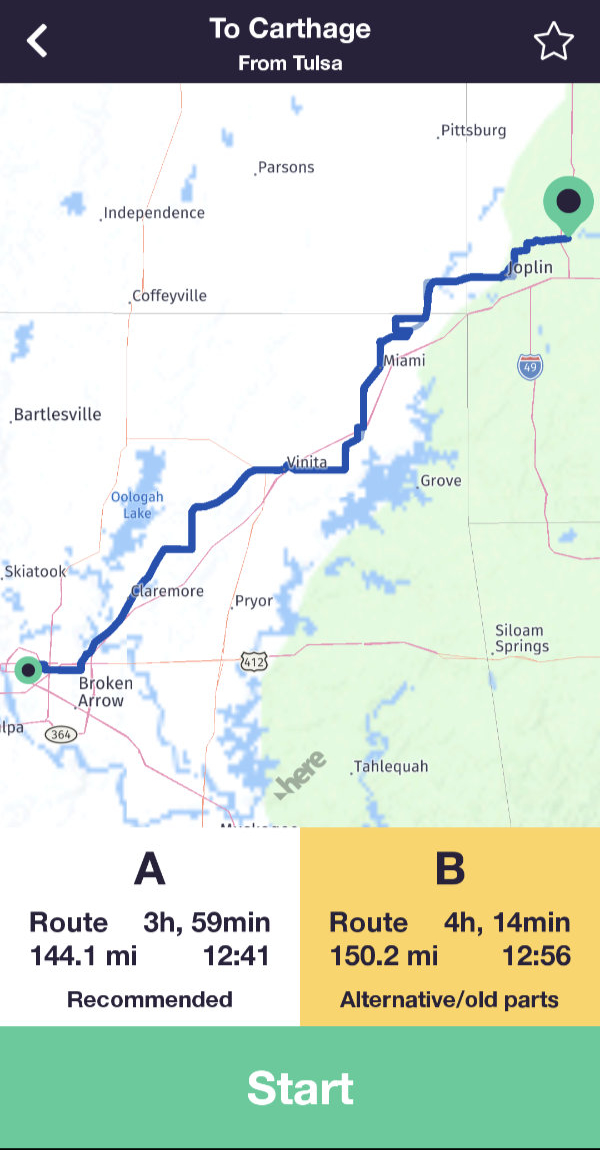
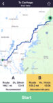 There were a couple of near misses and at least one false start but I finally got to give Touch Media’s Route 66 Navigation a try during my 2022 Christmas MOP trip. A winter storm interfered a bit with my plans so I made my trial headed northeast rather than southwest as intended. That really didn’t matter since the app supports travel in either direction. I began with a drive from Tulsa, OK, to Carthage, MO. The app offers two alignments and I went with the recommended “A” alignment. This appears to be the more “mainstream” of the two. The app uses current position and selected direction to determine a list of cities from which to pick start and end points.
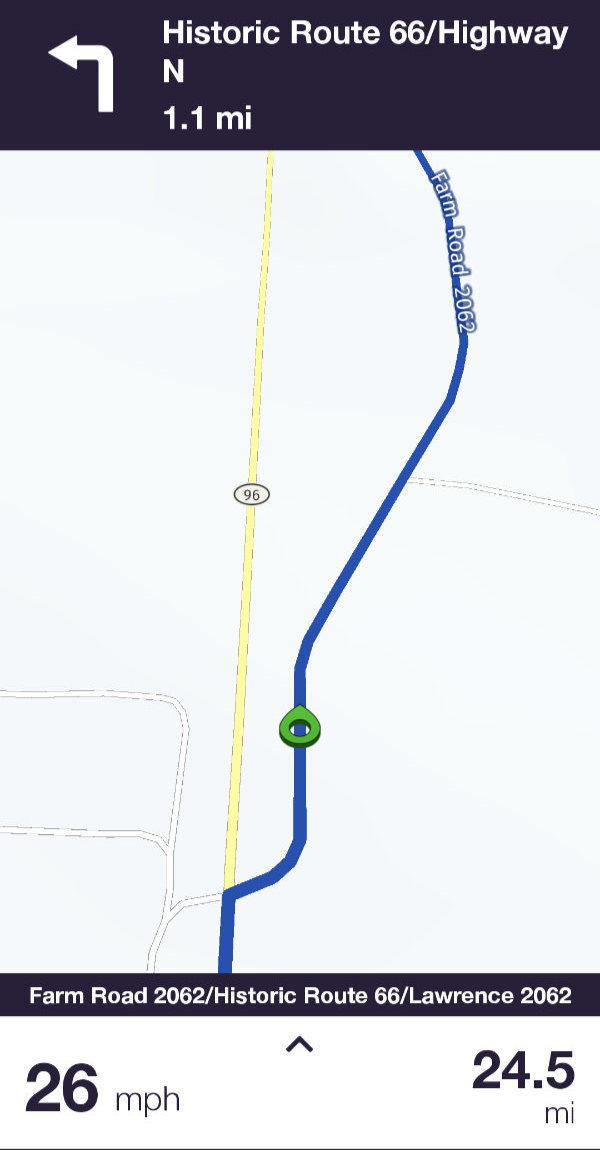
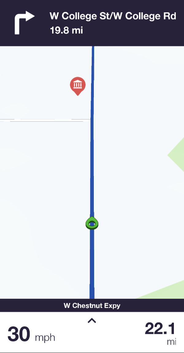
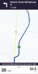 The route appears as a line on the map and it is never recalculated. That was my first real evidence that this product might be different from the rest. A circular green pointer tracks current position in real-time. The next driving instruction is displayed at the top of the screen along with its distance. Each instruction is announced vocally immediately after completing the one previous and at various points that follow. A final “Now turn left” or something similar is spoken with just enough time to complete the maneuver provided you are in the correct lane. These vocal instructions are quite important to me since I mostly travel alone. My phone or GPS receiver fills the role of navigator without arguing about turning back to photograph an old barn, complaining about me making the same wrong turn three times in a row, or decimating my snack supply.
 There is a gap in the app’s audible offerings that I think is kind of serious. It has knowledge of somewhere around a thousand points of interest along the historic highway. A visual notification appears when one of them comes near. That’s useful if you’re actually watching the phone but is almost always missed if you’re watching something else like the road. A spoken name or other identifier would be wonderful but even a simple beep, which is what the River Pilot Tours Garmin app did, would be enough. In fact, I initially thought that the beep I heard occasionally might be a POI alert but was unable to associate it with actual attractions. I eventually learned that it is a speed limit alert than can be disabled.


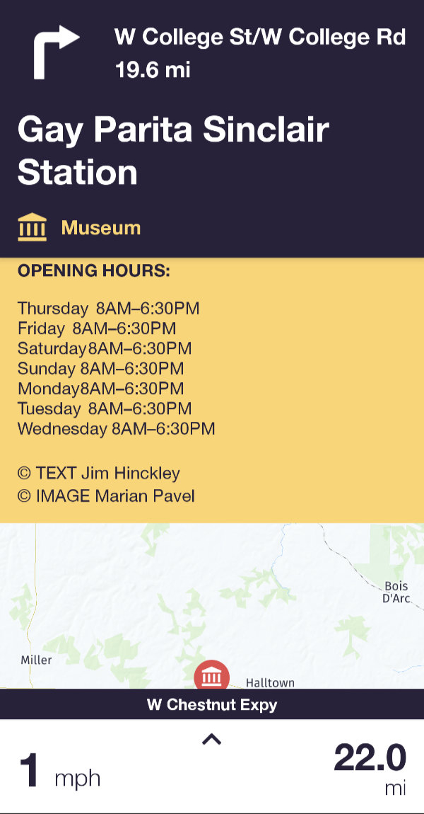
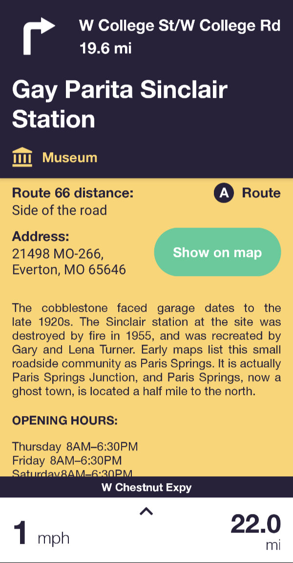
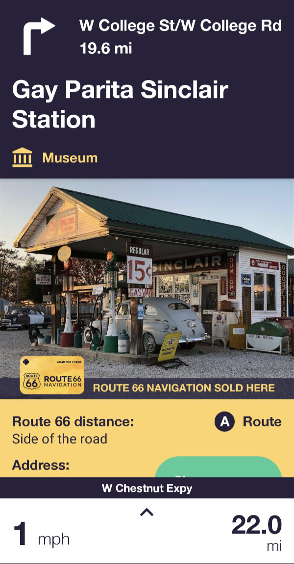
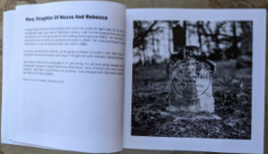
 Of course, that brief visual announcement is not the only way to learn of POIs. Markers for them are displayed on the map and there is a list organized by state. Details, such as those shown for Gay Parita, are accessed by clicking a marker or list entry and are available whether or not you are anywhere near Route 66. Navigating directly to a POI can be initiated from its detail page.
For me, how the navigation aspect of the app behaves when a traveler veers off of the route is arguably the most important question related to this product. Although veering off route is something I did many times (both intentionally and not), I somehow failed to grab a single screenshot of it. The short description is that it does pretty much what I think it should. For starters, it does not recalculate the main path. The line that represents Historic Route 66 remains in place. The app automatically calculates a path back to the nearest point on that line. This secondary path is constantly recalculated — as turns are missed and the nearest on-route point changes — until you are back on course. Excellent!
 There is much to this product that I haven’t explored or even touched on. I don’t even know for certain that my biggest negative, the lack of audible POI alerts, isn’t solvable by some setting that I haven’t found. I do know that the answer to my biggest question is yes. Yes, Route 66 Navigation will keep you on course along Historic Route 66. It will do it in both directions and will let you choose between a recommended and alternative path for your travels. Of course, there are many more than two possible paths on Route 66 and it is really impossible for any guide to offer them all. Identifying every possible point of interest is also near impossible and I can’t say for sure that one or more haven’t been missed. But the version I have installed lists 1,154 so it couldn’t have left out very many. Each entry contains a photo, a description, the location, and contact information if appropriate. The Touch Media staff has done an impressive job in pulling all this information together and Route 66 authority Jim Hinckley has supplied much of the descriptive text. In another stick-with-the-experts move, the RSS feed from Ron Warnick’s Route 66 News is used for the app’s own news section.
The app can be downloaded free from Apple’s App Store or Google Play and many of its features accessed at no cost. However, access to its real reason for existing, real-time navigation, requires a paid subscription. Because I have an active subscription, I cannot currently see the in-app pricing but do know that I paid $30.09 for a one-year Android subscription. Online sources show varying rates but all are somewhere around $20/week or $40/year. The price has triggered some negative comments and the fact that it is a subscription has triggered even more. Some of those comments are from people who think that all things digital should be free because no steel, gold, or vinyl is physically transferred. Those can be completely ignored.
I’m no different than most folks in instinctively preferring a one-time purchase over a subscription but I also understand that the purchase model might not be the best for products subject to frequent changes from outside sources. Route 66 Navigation is clearly one of those products. Over time, businesses and roads open and close, and reflecting the real world is key to this app’s value. Although “subscription” is an accurate label, thinking of Route 66 Navigation’s period-based payments as “rent” might work better for some people. Many Route 66 travelers rent vehicles for the trip. Renting or hiring a guide is not terribly different.
Regarding the price, everyone has to evaluate that for themselves. For this solo traveler, having a reliable navigator tell me when and where to turn without criticizing my driving or raiding my cooler is nearly priceless. I personally think Route 66 Navigation is priced right. Now, if I only had a way to make my phone behave similarly for routes I’ve plotted myself, I could ditch my Garmin or at least get by with a cheaper one.

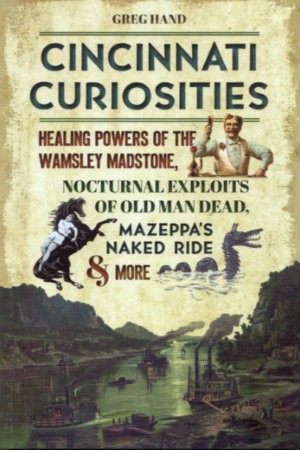
 Amy E. Brownlee is a lifelong Cincinnatian. She naturally learned a lot about the city growing up here then used that knowledge and added much more during her ten years at Cincinnati Magazine. An awful lot of the treasures she writes about in Lost Treasures of Cincinnati were lost before she arrived but a rather frightening number have disappeared during her lifetime. Of course, an even larger number have disappeared during mine. Neither of us is responsible for that. I swear it’s coincidence pure and simple.
 The book opens with “Food and Drink” in Section 1 then covers “Entertainment” and “Retail” in the next two sections. The smallest section, “Media”, is followed by the largest, “Community”. Definitions for those section titles are not particularly rigid and the size of the “Community” section probably indicates that it is the least rigid of all. It is where things like churches and breweries, of which Cincinnati had more than a few, appear.
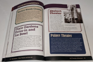 Most, but not quite all, of the breweries mentioned in the book were gone before I got here. Likewise with restaurants and attractions which together comprise the biggest part of things that have disappeared during my lifetime. I caught one show, Hair, at the Shubert (“Entertainment”) before it was torn down. I also saw one movie at the Albee (“Entertainment”) but I don’t remember what it was. I had one meal each at The Gourmet Room and the Maisonette (“Food and Drink”) before they closed. There are quite a few places in this book where I ate one or more meals or watched one or more movies, plays, games, or concerts. Encountering each of them on these pages prompted memories that went way beyond the single paragraph of text. Reading about places that were already gone when I came to Cincinnati didn’t prompt any memories, of course, but it did make me appreciate just how many treasures have been lost.
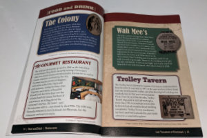 I really enjoyed reading Lost Treasures of Cincinnati cover-to-cover front-to-back but as I did, two other ways of reading the book came to mind. With its fairly short standalone essays, it seems like a natural fit for that popular personal reading room with the porcelain furniture. Its use as a reference book also seems rather natural. I don’t mean an every-last-detail reference book to use in conducting deep-dive research but a great place to answer questions like “What was the name of that boat-shaped restaurant?” or “What happened to our NBA team?”. The full index will help the book play that role.
 Greg Hand has been a man of letters — or at least a man of words — his entire adult life. He began as a newspaper reporter, moved up to editor, left to head up a university PR department, co-authored three books about the university while he was there, then retired. I was not even slightly aware of any of this as it was happening. I only became aware of Hand’s existence when I stumbled upon the blog he started post-retirement. His knowledge of local history and ability to dig up information to augment that knowledge was immediately apparent and I’ve been an ardent reader of that blog ever since that happy discovery. The blog’s name is Cincinnati Curiosities and it can be found
 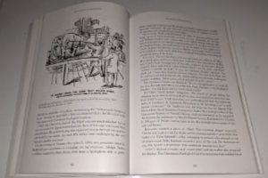 In fact, later in the book, Hand offers another very different capsulated view of the city. On December 12, 1890, he tells us, “The Palace Hotel had elephant steak on the menu because an elephant was executed by firing squad that morning at the Cincinnati Zoo. Hundreds of people watched. That pretty much summarizes Cincinnati in 1890.”
 “The Sensational and the Senseless” is the fourth of ten chapters. Other chapters tell of monsters in the Ohio River (“The Old Weird Cincinnati”), Fanny Trollope’s visit during the “Porkoplis” period (“Tales From the Old City”), the possibility that striptease was invented in Cincinnati (“Freaks, Flesh, and Footlights”), and a large variety of other topics. The striptease claim is based on Millie De Leon’s orchestrated removal of several garters in 1901, and Hand cites the claim in suggesting that a Striptease Hall of Fame might be an “appropriate addition to our Over-the-Rhine neighborhood”.
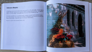
 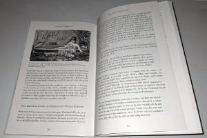 Hand’s usually light-hearted reports are often accompanied by contemporary illustrations. At left is a Pears Soap advertisement based on Lillie Langtry’s famous bath in Apollinaris water at Cincinnati’s Grand Hotel in 1883. It’s in the chapter titled “Nudity, Naughtness, and Negotiable Affection”, and if that doesn’t get you interested in the book I don’t know what will.
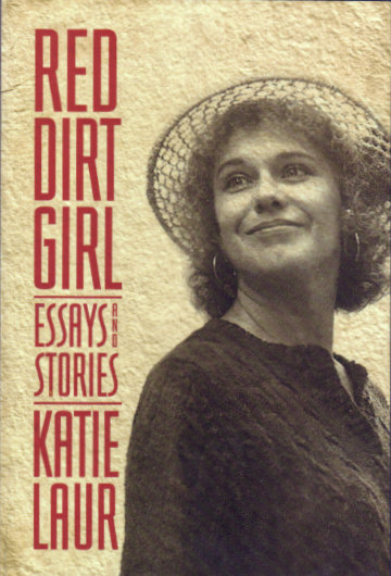 This was one of the most flat-out enjoyable reads I’ve had in a long time. I have seen Katie perform many times, heard her talk on the radio several times, and even chatted with her personally a few times. I knew her as a talented musician and entertaining storyteller but I did not know her as a writer. Others, it seems, have been aware of Laur’s writing skills for some time. It’s my impression that nothing other than the foreword, an introduction, and Katie’s acknowledgments was written specifically for this book. In one of the book’s essays, Katie talks of selling her writing and says she sold everything she wrote. From that, I assume that each of the essays and stories that make up Red Dirt Girl has previously appeared in print somewhere. Where I don’t know and regret that where ever it was, it was outside my field of vision. That I am only now seeing the literary side of Katie is very much my loss. This gal can write.
 This makes two consecutive book reviews that are seriously belated and that’s hardly their only connection. I wasn’t even aware of either the book or its author when I arrived at the 2022 Lincoln Highway Association conference but, John Jackson, co-author of
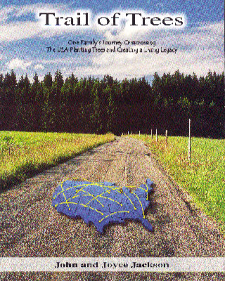
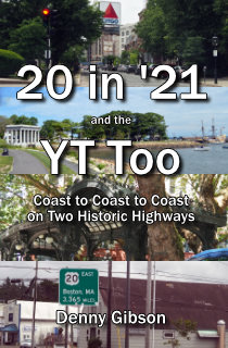 Missed it by that much. I had this really great idea for a book title, and even figured out the story that would fit it. I would drive one way across the country on the Yellowstone Trail and the other way on US 20. I would do this in the year 2020, and the resulting travelogue would be perfectly described by that catchy title: 20 in ’20 and the YT Too. But COVID-19 played havoc with 2020 travel plans and the wonderful title’s “best if used by” date came and went. I made the planned trip a year later and adjusted the title appropriately. It’s admittedly not quite the same but it’s not horrible. Is it? Well?
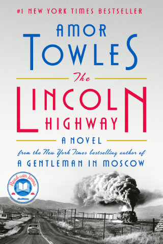 This post is a direct violation of one of the claims made on this blog’s “About” page. There the claim is made that “You will not be seeing a review of the latest novel…”. I suppose I could claim that, at the time of this review, The Lincoln Highway: A Novel is no longer the absolute latest novel, but the fact that it is a “#1 New York Times Best Seller” means it is precisely the sort of mainstream major publisher offering I had in mind when I made that claim. My primary defense is that I was tricked into reading it. Realizing that not everyone will see that as a legitimate justification, I will try to minimize the impact of the violation by not doing a very good job.