
 Everybody’s out of step except my boy Denny. That’s sure how it seems when the subject is GPS routing. I have once again purchased a Garmin product that disappoints me. It’s not that it doesn’t have some wonderful features or that it’s shoddily made. It’s because it doesn’t handle predefined routes the way I think it should. The out-of-step feeling comes from the fact that almost no one else sees any problem at all with the manner in which the unit plays back what it calls “Saved Trips” while I see some very big problems.
I wrote that opening paragraph over a year ago, shortly after I purchased the unit. I’ve been putting off finishing this article with intentions of gaining more experience with it and verifying or disproving some of my theories. Even after all this time, I’m still not sure if some of my theories are right or wrong, but I have gained experience and I do have a more informed opinion. Things aren’t quite as bad as I thought when I wrote that first paragraph, but they are a long way from good.
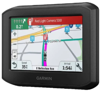
I’m thinking that for you to fully appreciate my viewpoint would require more background than I’m willing to write, and definitely more than you’re wanting to read. The most basic piece of background is that I want a GPS unit to feedback to me a route I’ve predefined. Garmin zūmos do that. Most GPS units do not. They provide a route of their choosing from where you are to where you want to be. Smartphone routing apps do this too. The 396 does this exceptionally well and even integrates with smartphones to provide traffic and weather information plus Foursquare and Tripadvisor ratings for restaurants and motels.
A rather basic requirement for following a predefined route is the ability to turn off automatic recalculation when you happen off of the route. Without this, the GPS will recalculate the route every time you miss a turn or pull over for gas. The 396 supports this but with at least one flaw. If a point on the route is blocked by construction or something else, the unit seems to take that as justification for ignoring the fact that automatic recalculation is turned off and just recalculates things anyway. Yes, I understand that that allows you to continue your travels without backtracking but it sure interferes with following an old road up to the edge of a temporary closure.
Of course, the ability to download those predefined routes is also a requirement, and here the 396 really missteps. I realize that infinitely long trips cannot be supported so I readily accept limiting or splitting trips at some point. 29 via points does seem a little low but this is the “economy” model. Maybe the more expensive zūmo XT supports more but that isn’t the real issue anyway. The real issue is that the Garmin unit does exactly what it says and splits the route into two (or more?) completely separate trips. When the endpoint of the first segment is reached, that fact is announced and it is left for some human to select and activate the next segment. To show how this didn’t have to be, I’ll make my first comparison to the previous generation of zūmos.
I own a zūmo 220 which, like the 396, is the cheapest of its generation. As far as I know, the only differences between it and its larger siblings, such as the 660, are screen size and (possibly) memory capacity. The 220 has a point limit, of course, but it appears to be somewhere around 200, and it is handled quite differently. When the limit is encountered during route import, the user is told that directions to points beyond the limit could not be calculated. Then, as those points are approached (and earlier points fall away) directions become available. There is no need to fumble around with route selection in the middle of traffic or drive on without directions while the GPS accesses the new route. Forgetting or maybe just tossing something that I think they did right in the past is the sort of thing Garmin does repeatedly.
To illustrate my more basic complaint about the 396, I’m going to again reference the 220. When a route is selected on the 220, it asks whether you want to go to the route beginning or not. If the answer is yes, it provided directions to the start point then switches to the selected route without manual intervention. If the answer is no, the route is plotted and displayed. Intersecting it at any point causes the GPS to begin guiding you along the path. It’s the same operation all along the route. You can drive off of the route and even loop backward or skip ahead and the little colored line is waiting for you to intersect it at any point. You can even deactivate the route by having the GPS take you to a motel or some such then reactivate and rejoin it whenever you’re ready.
 With the 396, you MUST select one of the route’s waypoints before starting and you MUST physically reach it or manually skip it which simply selects the next one. Of course, I really don’t want to manually pick a starting point, but even if I did my routes contain mostly automatically generated point names which provide little help in selecting one.
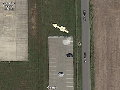
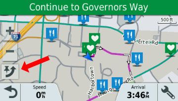 I guess that isn’t an issue when starting a route at the very beginning but it certainly is an issue when joining (or rejoining) a route in the middle. I did try to simulate the desired operation by selecting a point prior to the one I knew to be next, driving to intersect the plotted line, then skipping (red arrow) the selected point. I’m not 100% sure this actually works without altering the path to the next point, but even if it does, it’s a complication that did not exist in the prior model.
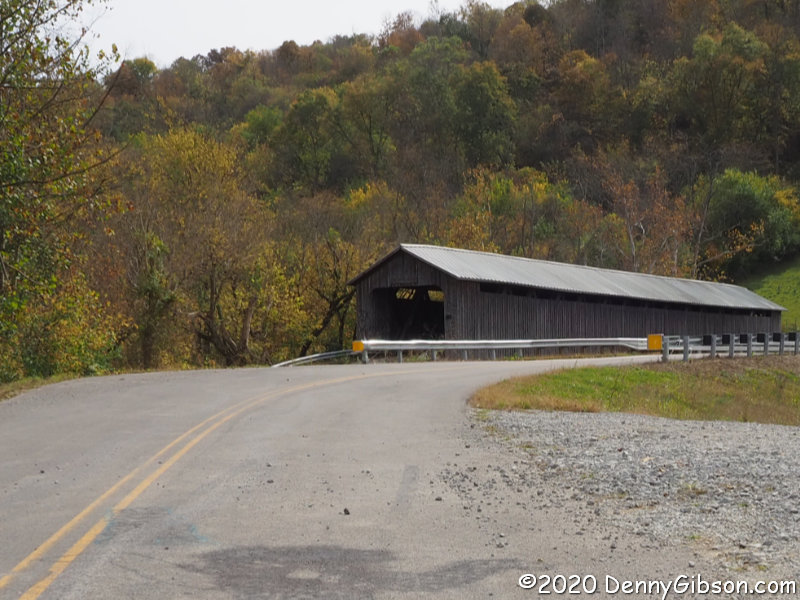
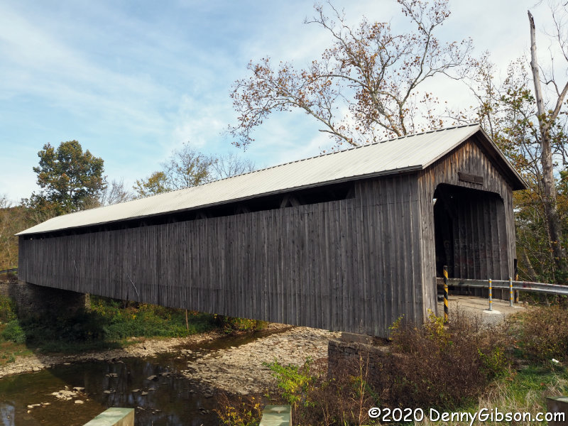
In September, I finally got serious about using the 396 on a trip with a route that I really wanted to follow. It was an all Ohio trip I split into separate north and southbound segments but I still encountered the 29 point limit on the southbound segment and it was on this trip that I discovered the calculation setting override related to blocked roads. I went through the motions of trying it on a recently ended twelve-state trip but I already knew it wasn’t going to work. The trip was already split into sixteen segments. The 396 split most of those in half and simply refused to load the longest of them. I sort of used it for the familiar first leg but quickly switched to my beaten but still breathing 220 for the rest of trip. I did keep the 396 powered on to record a track for geotagging and to find motels but it was the 220 whose directions I followed. Garmin, you blew it again.
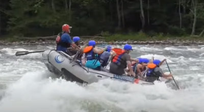 Like many, I’ve thought of writing a memoir. Maybe I already have. Considering that “a memoir is a form of creative nonfiction in which an author recounts experiences from his or her life”, each of the travelogues I’ve published might qualify. But it’s when I remember other, not necessarily travel-related, experiences from my life that the word memoir enters my head. That happened today. I’m reading Down the Great Unknown about John Wesley Powell’s pioneering trip down the Green and Colorado Rivers and just finished a section discussing the sensations of traveling through whitewater. It naturally made me recall some of my own whitewater experiences. There aren’t all that many, but there are a couple I’ve thought of writing down in the past. The dearth of new subject matter resulting from the current coronavirus quasi-quarantine combined with today’s memories prompted me to begin a series of “memoir posts” and kick it off with this rafting story.

 Like the first My Caboodles chapter, this third installment contains just three items. Some might consider it less than a full caboodle and I suppose, if a National Caboodle Association is ever formed, I might be called out on it. Here’s my thinking.
 I really don’t like writing things that make others look bad and no one likes writing things that make themselves look foolish. Today I’m doing both.
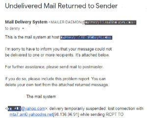 It’s terribly inconvenient, of course, but is usually solvable in a reasonable amount of time. Many blacklists are public with established procedures for getting off of them after proving the bad guy is gone. That’s not the case with Yahoo. Nor is it now the case with AOL and Verizon since, through purchases and mergers, they’re all one happy and secretive family. Their lists are essentially private and getting removed from them (i.e., restoring your reputation) is not very easy. I’m sure that knowing that made me more tolerant as weeks then months slid by with no resolution.


 We fought a war to get this country going then gave every land-owning white male above the age of twenty-one the right to vote. A little more than fourscore years later, we fought a war with ourselves that cleared the way for non-whites to vote. Several decades of loud, disruptive, and sometimes dangerous behavior brought the granting of that same right to non-males a half-century later, and another half-century saw the voting age lowered to eighteen after a decade or so of protests and demonstrations.
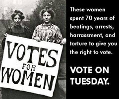 Of course, putting something in a constitution does not automatically make it a practice throughout the land and I am painfully aware that resistance followed each of those changes and that efforts to make voting extremely difficult for “the other side” are ongoing today. I don’t want to ignore partisan obstructions and system flaws but neither do I want to get hung up on them. I meant my first paragraph to be a reminder that a hell of a lot of effort, property, and lives have gone into providing an opportunity to vote to a hell of a lot of people. Far too many of those opportunities go unused.
 I first posted the core of this article in 2014. In the original title, I claimed to not care how anyone votes. That was never entirely true, of course. I have my favorite candidates and issues. I’ll be disappointed in anyone who votes differently than I do but not nearly as disappointed as I’ll be in anyone who doesn’t vote at all. I’m reminded of parents working on getting their kids to clean their plates with lines like, “There are hungry children in China who would love to have your green beans.” I’m not sure what the demand for leftover beans is in Beijing these days but I’m pretty sure some folks there would like to have our access to ballots and voting booths.