Book Review
Route 66 Encyclopedia
Jim Hinckley

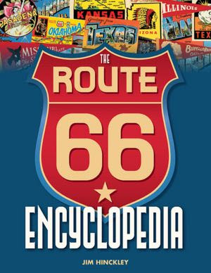
Route 66 Encyclopedia - coverE-N-C-Y-C-L-O-P-E-D-I-A
I can’t look at this book without hearing Jiminy Cricket singing. I’ve never read an entire encyclopedia (Including this one — yet) but thanks to Pinocchio’s little bitty buddy, I can spell the word.

I’ll confess to being a little leery every time I hear of a new Route 66 book. How many books does one road need? I think I was doubly leery of this ambitious project because, as Jiminy says, an encyclopedia contains “everything from A clear down through Z” and that’s a tall order. Well, Jiminy… I mean Jim seems to have done a pretty good job covering the alphabet and I’ve once again discovered that Route 66 needed at least one more book.

The encyclopedia made a good impression before I ever read a word. It’s a fairly large hardback with full color glossy pages. The book’s first page folds out to present a three panel map of the entire road lined with photos and images from postcards, maps, and brochures. It is well illustrated throughout with modern photographs from Jim and wife Judy and lots of historic images from collectors Joe Sonderman, Steve Rider, and Mike Ward. It looks like Rider, at least, also contributed some modern photos. I probably ought to mention that I personally know all those guys and Jim, too, but I don’t believe I owe any of them money.

As might be expected, the entries are in alphabetical order and the starting page of each letter can be determined from the table of contents. Only ‘X’ is a no-show. ‘Q’ and ‘Z’ get one page each and ‘C’ gets thirty. The rest get something in between. There is a large letter at the outer top corner of each page to further help with locating topics. There is also an index but it is a bit unusual, at least in my experience. Rather than a single alphabetical list, there are sub-lists for people, places (further divided by state), other, and publications. It’s quite usable but it seems like it could get awkward if there were many more divisions or longer lists.

I expected to encounter some new stuff here and I certainly did. The book starts and ends with things I’d not heard of: Missouri’s Abbylee Motel and New Mexico’s Zuzax trading post. There are plenty more in between. Among the many entries that weren’t at all familiar to me are quite a few defunct businesses such as Drumm’s Auto Court in Arizona and the Premiere Motel in New Mexico, several vanished communities including Des Peres, MO, Lela, TX, and Siberia, CA, and at least a few humans. I don’t recall ever hearing of businessman Arthur Nelson and, while it seems like I must have at least read about “father of the good roads movement” Horatio Earle, I sure didn’t recognize the name. On the other hand, a couple searches for folks I did know of came up empty but I believe that, too, is to be expected. It really isn’t possible to include absolutely everything and choices must be made. Every “Best Beatles Songs” list I’ve ever seen has left off at least one of my favs.

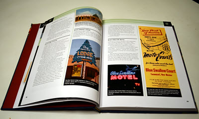
Route 66 Encyclopedia - sample 1This is not my first exposure to Hinckley’s work and, as I’ve said before, the man does his homework. Of course, everybody knows about the Gemini Giant and it’s not too tough to learn that it was made by International Fiberglass. But learning how many cowboys the company made for Phillips Petroleum and how they managed to make some giants with beards and some without and that the company’s founder once set a world record in sailing? That takes some digging. And practically any book with 66 on the cover will tell you how Cyrus Avery was instrumental in getting the pair of sixes for the route after the desired Highway 60 designation was assigned elsewhere. Hinckley does that and also tells us quite a bit about some of his other activities such as his prior role in creation of the Albert Pike Highway and his subsequent role in helping form the U.S. 66 Highway Association. Incidentally, although I have not read every article in the encyclopedia, that is the only mention of the U.S. 66 Highway Association I found. Its post-WWII spark plug, Jack Cutberth, was one of the names I thought I might see in the book but didn’t.
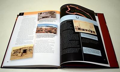
Route 66 Encyclopedia - sample 2Even without Cutberth, the Route 66 Encyclopedia includes an impressive number and range of articles and many of those articles go into significant depth. The writing isn’t flowery but neither is it terse. It’s lean and efficient. The goal is to get as much factual information between the covers as possible and keep it readable. Hinckley does that rather well. Moreover, I think you’d probably still get your money’s worth if you decided to forgo the text altogether and just look at the pictures.
Encyclopedia Britannica always had yearbooks. (To my surprise, I just learned they still do.) The Route 66 Encyclopedia has updates here. They can also be accessed through a QR code on the back of the book.

The Route 66 Encyclopedia, Jim Hinckley, Voyageur Press, 2012, hardback, 11.1 x 8.7 inches, 288 pages, ISBN 978-0760340417
Available through Amazon.

Book Review
Ten Million Steps on Route 6
Joe Hurley & Travis Lindhorst

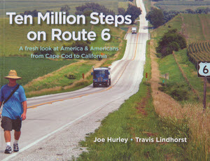
Ten Million Steps - cover“It’s not the destination but the journey.”
“Life begins at the off ramp.”
“Getting there is half the fun.”
Most people who visit this website are probably familiar with those and similar quotes. How about “Friends don’t let friends walk the interstate”?

I and a lot of folk I know preach about taking back roads and slowing down. Joe Hurley took that idea a few million steps further and not only stopped to smell the roses, he saw them get watered and watched them grow if only a smidgen. Starting at the east end of the longest US highway that ever existed, Joe spent about eight months walking its full length. He didn’t really count each step or measure each mile but 10,000,000 of one and 3600 of the other are believable round number estimates. While Joe was walking, Travis Lindhorst, his camera wielding partner, was driving. Joe was within hailing range of sixty and Travis was twenty-seven. Perhaps that saying about wisdom coming with age is not universally true.

This is not a guide book. There are some maps but they are not of a scale suitable for navigation. They’ll show you that US 6 goes through the north part of Indiana and the south part of Nebraska but that’s pretty much the limit of their detail. And Joe does occasionally mention where he slept or ate but the mentions are neither regular nor recommendations. The book resembles a collection of newspaper columns. Some bits that now appear in the book were, in fact, published as stand alone articles during the trip to help finance it but many were composed well after the walk was over.

Hurley retired as a columnist for a Danbury, Connecticut, newspaper shortly before starting his 2004 cross country walk so it is natural that this book is a compilation of column-like articles. As I read Ten Million Steps…, I was reminded of collections I’ve read from another newspaperman, Ernie Pyle. For several years before the start of World War II, Pyle was a popular travel writer. He posted his personal human interest style observations from wherever he happened to be. Joe Hurley’s observations seem a lot like Pyles although they are 70+ years newer and organized in a single line rather than a wild scatter pattern. As presented in this book there is another big difference. Ernie Pyle didn’t have Travis Lindhorst beside him.

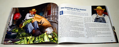
Ten Million Steps - sampleSometimes Lindhorst’s photos are coordinated tightly with Hurley’s text and sometimes they just represent the general area. Either way they are always wonderful additions to the story. Some would be right at home in a super-wide hardback coffee table book but then I probably couldn’t afford it. The fairly large format paperback with glossy pages serves the photos well in an affordable package.
Route 6 goes through big cities like Cleveland and Chicago and Hurley neither bypasses them or ignores them in his writing but most of the stories come from the small towns and open spaces in between. He talks with the manager of a bookstore in Yarmouthport, MA, an auctioneer in Foster, RI, and the manager of a tiny theater in Newtown, CT. He stops by the Harness Racing Hall of Fame in New York and a little league game in Pennsylvania. In Galton, PA, he talks with a women who tells him “I spent 16 years scrimping and saving to get out of here then I spent the next 16 years scrimping and saving to get back.” Out west Hurley looks over the remains of Topaz, a WWII Japanese interment camp and walks through a snow storm while covering the all but empty 160 miles between Ely and Tonopah, NV. In between were a lot more towns, a lot more people, and a lot more country. Two locations that Joe counted among his favorites are the Rialto Theater in the not-all-that-small town of Joiet, IL, and Glenwood Canyon in Colorado. Of the latter, Joe says, “I’ve traveled across the United States and nothing has beguiled me more than Glenwood Canyon.”

Joe and Travis and Route 6 and the Geo Metro that Travis used to drop off and pick up Joe each day all made it to California. Only Joe and Travis made it to the coast. In 1964, Route 6 was truncated and Bishop, CA, became its western terminus. Joe and Travis said goodbye to the work-horse Geo when the brakes pretty much vanished during a side trip to Death Valley. To meet their now firm end date, they left the ten year old car with a junkyard mechanic who promised to repair the car and give it to an elderly gal in need of transportation. After the run of its life, the red Geo just might be fetching groceries at the edge of Death Valley.

The current US Highway 6 may officially end just over the California line but the pavement it once followed west is still there and Joe kept right on walking until he reached the Pacific Ocean at Long Beach. West of Bishop, the former US 6 now goes by names like CA 395 and CA 14.

Back on Cape Cod, the traveling odd couple had dipped their hands in the Atlantic. At the end of the Pine Street Pier, they dipped them in the Pacific then Joe and his wife spent a couple of nights on the Queen Mary. I’m guessing that Joe spent a significant amount of his shipboard time with his feet propped up.

Route 6 is a great road. The few sections I’ve driven (MA, PA, UT) have gone through some mighty pretty country and I’m very glad that Hurley chose it for his walk. But I’ll still risk saying that this book could have been written in large degree on several roads other than US 6. Route 6 took Joe across the whole country and gave him a bigger than average sample size but the the book is not about directions and turns. It’s about people and places and steps and stories and it’s a darned good read. More information at route6walk.com.

Ten Million Steps on Route 6, Joe Hurley and Travis Lindhorst, Arkett Publishing, 2012, paperback, 8.5 x 11 inches, 240 pages, ISBN 978-0981678165

Book Review
Stay on Route 6
Malerie Yolen-Cohen

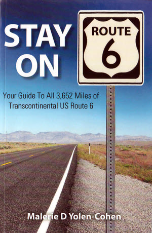
Stay On Route 6 coverMuch like the subject highway, my opinion of Stay on Route 6 has gone “coast to coast”. In the end, I settled slightly inland on the positive side.

I was pretty excited when I first learned that an established travel writer had published a book on US 6. My excitement faded as I read the introduction and it was replaced with disappointment after I’d read a few pages of the “guide” portion. I paused then took a look at the blog the author had launched as she prepared for the cross-country trip that would become this book. This somehow allowed me to let go of my preconceptions and accept the book for what it is. It is not a guide to the bypassed twists and turns of a historic highway. It is a guide to food, lodging, and attractions along the current path of a highway with history.

The seeds for recognizing my preconceptions were planted as I read the book’s introduction. That’s where Yolen-Cohen tells readers that Route 6 is not Route 66 and details some of the differences. The need to do this may be irritating but it is a fact. For many people, the only roads they know of are the interstates, some local streets that lead to jobs and shopping, and a mythic Route 66. It is a wonderful thing that Route 66 has the recognition that it does but it sometimes blurs people’s perception of other roadways. I am quite familiar with the phenomenon. I have had several conversations with folks who expected the Lincoln Highway, the National Road, or the Dixie Highway to be just another Route 66 and were disappointed that they are not. It turns out I was guilty of something similar. I don’t believe it was anything in the actual blog that did it but as I read some of the early entries I realized that my disappointment in the book wasn’t very different from that of those travelers. I wasn’t disappointed in the book because it was a bad guide but because it was not like the guides I was familiar with for Route 66 and other historic highways.

So once I got my own expectations adjusted, I found that the book was pretty good at doing what Yolen-Cohen intended. It covers the entire route, offers some casual commentary on the country along the way, and describes most cities and towns it passes through. Sleeping and eating establishments are noted with a distribution that should ensure no one using this guide goes hungry or has to sleep in their car. The emphasis is on locally owned businesses and the owners are typically identified right along with their bistro or B&B. Yolen-Cohen met these people on her 2011 drive so her recommendations have a personal touch. Nearby attractions are also identified and I very much appreciate the effort to visit and describe local museums. I like local museums. Contact information including, where possible, address, phone number, and website, is included for each restaurant, lodging, and attraction.

I can’t swear to there not being other travel guides created as this one was but I don’t know of any. Guides like the ones I mentioned for faded historic routes are typically put together by someone intimately familiar with the road through years of exploration. On the other hand, my impression is that many dining and lodging guides are put together by someone sitting at a desk using a phone and computer to gather recommendations from chambers of commerce and other boosters. Yolen-Cohen certainly did some recommendation gathering but she did it specifically for her trip. She selected and scheduled almost all of her stops before leaving home then colored things in with a single cross country run.

I like that. I like the idea of a single road trip — even one meticulously planned — giving birth to a travel guide. Yolen-Cohen describes this as a lifelong dream. A little innocence even shines through the possibly jaded view of the experienced travel writer. At least it does in the blog. The blog (stayonroute6.blogspot.com) is part of the whole. The book contains some low-resolution maps and some black-and-white photos. The maps help with mentally placing general locations but a traveler is expected to follow the route with posted signs and modern maps. Similarly, the photos help us understand some of what Yolen-Cohen saw on her trip but little more. This is a black-and-white paperback guidebook, not a full-color photo book. It belongs on a car seat, not on a coffee table. But Yolen-Cohen did take color photos and video, too. Both appear on the blog and are worth checking out.

There are few turn-by-turn directions in the book. They are not needed since it is following an active and signed US highway. That is until it isn’t. US 6 was once truly coast-to-coast and ran from the tip of Massachusetts to Long Beach, California. In 1964 the western end was truncated to Bishop, California. Yolen-Cohen carries on, however, and does provide turn-by-turn instructions for following the former US 6 to the coast.

I don’t know of any significant errors in the book but I do know of two insignificant ones. At least they should be insignificant. It’s even possible they would have gone unnoticed if the author hadn’t gone out of her way to draw attention to them. The first one is in the introduction and is partly responsible for me almost giving up on this book early. Calling an “association” a “society” sets the stage for Yolen-Cohen’s joke about the “unfortunately acronym’d ASSHO”. I’m sure this was a legitimate mistake but the fourteen months between the goof’s appearance in the blog and the book’s publication seems ample time to realize that the organization in question is the American Association of State Highway Officials (AASHO).

The second is when the author berates a Joliet, Illinois, museum that touts US 66 for not also touting US 6. This seems a little off-key since the differences between a historic decommissioned Route 66 and a living breathing Route 6 have been duly stressed. But it turns even more sour with the realization that, despite claims that the museum “occupies the corner of Route 66 and Route 6”. US 6, according to all maps I’ve checked, never gets within half a mile of the museum. A living breathing US 30 does pass by the museum. There isn’t a US 30 section in the museum, either, but a Lincoln Highway (US 30’s predecessor in these parts) display has just been added.

But, even though these errors are quite annoying to me personally, they do not make the book less useful. Anyone looking for a place to eat or sleep anywhere along this long highway can certainly benefit from Stay on Route 6 and the number of museums and other attractions included makes it valuable for sightseeing, too. It’s kind of refreshing to see a guide for a highway that hasn’t been declared dead by someone.

Stay on Route 6, Malerie Yolen-Cohen, CreateSpace, May 2012, paperback, 5.5 x 8.5 inches, 257 pages, ISBN 978-1468049398
Available through Amazon.

Book Review
Fips, Bots, Doggeries, and More
Tracy Lawson

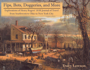
Fips, Bots, Doggeries, and More coverIn 1990, Tracy Lawson’s parents gave her a stack of twenty-one photocopied pages as a Christmas present. Transcribed onto the typewritten pages was the journal of her third great-grandfather’s 1838 trip from a Cincinnati suburb to New York City. In 2012, Lawson is sharing those pages and the experiences they triggered, in Fips, Bots, Doggeries, and More. The book is comprised of two sections. “Section I — 1838” contains the journal along with Lawson’s illuminating comments and notes. “Section II — 2003-2009” contains accounts of the author’s own trips along the route. Both sections are liberally illustrated with black and white photos and drawings.
The writer of the 1838 journal was Henry Rogers, who operated a successful mill in Mount Pleasant (now Mount Healthy), Ohio. Traveling with the 32 year old Henry were his wife and her parents. The miller was both literate and observant and he sets out to record “…all interesting subjects and things that come under my observation”. The journal provides a most interesting look at nineteenth century road-tripping. Henry recorded expenses and named names so we know, for example, that the group spent a night at Winchester’s hotel in Jefferson (now West Jefferson), Ohio and paid $2.50 for the privilege. That $2.50 covered bed and board for four people and two horses. Along the way, he records expenses for tolls, horseshoes, wagon tyres, and “face barbering”, etc..

The travelers picked up the National Road in Jefferson, Ohio, and followed it and its extensions to Hagerstown, Maryland. As a fan of the National Road, I enjoyed reading Henry’s descriptions and found his pre-bridge entry to Wheeling, Virginia, which required a ferry over each of the two Ohio River channels at costs of 25 and 37.5 cents, especially interesting. They passed through Brownsville, Pennsylvania, during construction of the first cast iron bridge in the United States. It doesn’t appear as if Henry realized that the bridge that would soon carry the National Road over Dunlap’s Creek was the first of its kind but he described it as “splendid” while being forced to cross on an “..old narrow bridge that looked as though it would scarcely bear its own weight.” At Hagerstown, the group turned northeast and headed toward Gettysburg, Pennsylvania, then through Abbottstown and York to Lancaster. Roadies will recognize the Gettysburg to Lancaster route as the future path of the Lincoln Highway. From Lancaster, they continued northeast to Trenton, New Jersey, where they spent a little time and made a visit to Philadelphia before moving onto New York City.

The 1838 journal is accompanied by sidebars that explain unfamiliar terms or provide background for certain passages. The journal’s text is cross referenced to a set of end notes. A subsection titled “Expansions” contains short dissertations on subjects that were part of Henry Rogers’ world. These include mills, finances, politics, medicine, fashion, and more.

The author made three trips specifically to experience and research the route her great-great-great-grandparents had followed. Two were driving trips with her daughter and one was a solo fly-and-drive outing. These trips are covered in “Section II” with a blend of genealogy, personal discovery, and general history. It’s fun reading that mirrors Henry’s journal in the sense that both are straight forward reports of some relatively unscripted travel. Henry’s journal held my interest more but there is a good chance that this was because his travel was so much different from today’s. Lawson describes some of the places she stayed and ate much as Henry did and there is even an encounter with a less than savory character that is reminiscent of some of the “scoundrels and topers” encountered by Henry. But Ramada and Cracker Barrel don’t have the same zing as names like Sign of the Bear and Cross Keys Tavern.

Lawson does locate and visit several of the places mentioned in the journal including a few, such as Pennsylvania’s 7 Stars Inn, that are still operating. She also picked up some information at libraries and local historical societies though the trips were not as rich in field research as she had hoped. They were more successful, it seems, on a personal level. She was able to familiarize herself with the path her ancestors traveled and the world they lived in. The mother-daughter time was, as the ads say, priceless.

That personal connection won’t be there for most readers of Fips, Bots, Doggeries, and More, but it is still an entertaining and informative look at a road trip back when thirty-one and a half cents fed a family of four and two horsepower was plenty.

There are some minor errors. Perhaps I’m just sensitized to this sort of thing but referring to US 36 as State Route 36 and saying the Madonna of the Trail Monuments were “erected … on US Route 40 and US Route 66” with no mention of the National Old Trails Road bothered me. Aside from increased knowledge of her own ancestors and the world of 1838, it seems Tracy Lawson gained some insight into heritage road trips. In the Epilogue she says “And if I were driving the National Road again, I would eat at all the restaurants that were once taverns Henry mentioned in his journal!” I hope she makes that happen.

Fips, Bots, Doggeries, and More, Tracy Lawson, The McDonald & Woodward Publishing Company, April 2012, paperback, 9.1 x 7.1 inches, 156 pages, ISBN 978-1935778196
Available through Amazon.

Book Review
Oklahoma Route 66
Jim Ross

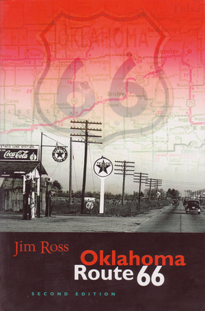
Oklahoma Route 66 coverI like this book so much that I have three copies of it. Well, maybe not three exactly but more than two. I got my first in 2007 in anticipation of an Oklahoma trip. It didn’t take me long to discover that the copy was flawed and it didn’t take much longer for a replacement to be provided. A printing error had caused many pages of that first copy to be omitted, duplicated, or otherwise jumbled. The replacement, with all pages present and in the right place, was quite an improvement. This second edition is also an improvement though not that drastic. With it’s accidental mishmash of pages, that first copy was essentially unusable. Every other copy of first edition Oklahoma Route 66 was eminently usable. The second edition is even more so.
The book’s organization is essentially unchanged from the first edition, Michael Wallis’ “Introduction” has been replaced by a “Foreword” written by Jerry McClannahan and Ross’ own lead in, which was once called a “Foreword”, is now a “Preface”. But, as Shakespeare might say, an introduction by any other name would still introduce and both Jerry and Jim do just that. Jerry helps to establish Jim’s credentials in a fun to read couple of pages then Jim fills in a little of the space between the two editions. He also explains, just as he did in the first edition, that this is literally a book about the road. Roadside attractions and Route 66 personalities are not entirely ignored but they are secondary. The route itself is the book’s focus.

Where did it go and when did it go there?

Jim Ross is really good at digging out answers to that question as well as communicating them. It is in communicating the route’s changing course that this edition’s biggest single change, color, really pays off. As Ross says himself in that preface, it is “…nice for the photos, but especially helpful with the maps.” Photos and other images are used extensively throughout the book. Some are newly acquired and in color though many are the same ones that appeared in the previous edition but now printed in color where applicable.

I don’t believe that any maps have been added to this edition though many have been revised to reflect changes on the ground or better understanding of past alignments. There are, of course, quite a few “past alignments” to be dealt with. In the earlier edition, dealing with them meant annotations on black and white maps. It worked. The information was certainly there and it could be extracted with a little reading and thought but it is so much easier when a green line marks the original alignment and other colors mark later alignments.

The maps appear in a section titled “The Tour”. It follows those introductions and short sections on the road’s history and construction and an explanation of the maps. “The Tour” is the heart of the book and it does indeed serve as a guide for an east to west tour of Historic Route 66 all the way through Oklahoma. Driving instructions are for what Ross calls a “through” route. This means that dead-ended abandoned stretches are not included. They are shown on the maps, however, and described in the text so someone set on finding every possible inch of Sixty-Six can do so. The text also describes the communities along the route and some of the landmarks in between and it usually provides some interesting history on those communities and landmarks including some that no longer exist. The tour is well illustrated with photos and other images and they are not just filler. Ross is as well known as a photographer as he is an historian. His own current photos are mixed with some by others and quite a few historic ones from various archives. “The Tour” of Oklahoma Route 66, even in an armchair, is far from boring.

Oklahoma Route 66 second edition, Jim Ross, Ghost Town Press, October 2011, paperback, 9 x 5.9 inches, 220 pages, ISBN 978-0967748177
Available through Amazon.

Book Review
Wabash 1791
John F Winkler

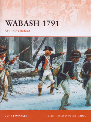
Wabash 1791: St Clair's DefeatBack in November, I stopped at Fort Recovery specifically to pick up a copy of Wabash 1791: St Clair’s Defeat and to hear the author speak. There’s a blog entry about that visit here. John Winkler began his talk that day by briefly describing the circumstances that preceded the battle then, while frequently pointing to a projected map of the battlefield, he stepped through November 4, 1791, by locating key figures and events in space and time. He spoke from memory and it was obvious he knew his stuff. The knowledge he demonstrated in that talk fills the pages of Wabash 1791. In fact, the book could be considered a hard copy version of that talk — with a few thousand-fold increase in detail.
Winkler begins the book, as he did that presentation, by talking of things that led to the battle only here he is not quite so brief. The world at the end of the eighteenth century can be pretty tough for modern-day readers to imagine. When the Battle of the Wabash took place, the United States constitution was barely three years old and our very first president was only halfway through his first term. The Ohio River was the nation’s border. England was still very much a military presence in North America and would officially be at war with the US in another twenty years. In 1791, there were plenty who thought England just might be picking up the pieces of her old colonies once the US collapsed.

After Winkler describes what he calls “The Strategic Situation”, he moves on to describe the opposing forces. The leaders of the two armies were certainly different but all were among the best of their time. St Clair, Butler, and Darke are just a few of the proven officers leading the Americans. On the Indian side, an equally qualified group of leaders surrounded chiefs such as Little Turtle, Blue Jacket, and Buckongahelas and the hated renegade Simon Girty. Also present were some out-of-uniform British officers. At the level of individual combatants, however, different meant unequal.

Recruiting had not gone well and continuing supply problems made it worse. Delays in supplies resulted in expiring enlistments and lack of supplies hampered training. In a sad “For want of a nail the shoe was lost…” style example, a shortage of paper led to a shortage of musket cartridges for training and target practice. As hard as it is to believe, some new recruits marched out of Camp Washington without ever having fired their guns. By contrast, fighting was part of every Indian’s life. Winkler quotes an officer who wrote, “…war is their principal study, in this they have arrived at considerable perfection.”

I hesitate to use the word “scholarly” but it really is appropriate for portions of the book. In particular, some of this early background information reads like a textbook and can be rather dry going. But there’s lots of good information being conveyed and the payoff occurs when the battle begins. Winkler can report the action without the need to repeatedly explain why one side did this and the other that. And report the action he does and it is brutal. Though the two armies were roughly equal in size, approximately 1700 soldiers and militia versus 1400 Indians, most of the experience and all of the surprise was with the Indians.

Two types of illustrations augment Winkler’s battle descriptions. Color-coded diagrams show three stages of the battle and artist Peter Dennis has produced three “snapshots” to help visualize the scene. The one used for the cover shows Captain Henry Carberry shouting at the demoralized soldiers to charge the encircling Indians simply in order to escape. Numerous photographs and drawings illustrate other sections of the book.

More US soldiers died that day than in any battle prior to the Civil War. This battle was the greatest victory American Indians ever achieved over US forces. The loss nearly eliminated all United States military capabilities and had the potential for destroying the young nation. In fact, a proposed investigation into supply chain corruption was abandoned to avoid that very risk. With the passage of time, this clearly significant battle has been largely forgotten by non-historians. How much success Winkler’s book has in reviving the memory is yet to be seen but it seems to contain all of the details needed for filling in the blanks.

Wabash 1791: St Clair’s Defeat, John F Winkler, Osprey Publishing, November 2011, paperback, 9.6 x 7.1 inches, 96 pages, ISBN 978-1849086769
Available through Amazon.


I’ve seen other accounts of St Clair’s Defeat. Allen Eckert’s fairly short one in That Dark and Bloody River is a pretty easy read. Eckert writes in the style of a novel with the factual base of a text book. In my youth, as I was first learning of the battle that occurred just about fifteen miles from where I grew up, I formed the impression that St Clair was a bumbling idiot and was almost single-handedly responsible for the disaster. As I learned more about the supply and equipment problems, my view softened. Eckert blames St Clair for not aborting the campaign in light of the huge recruiting and supply issues but little else. Winkler hardly blames him even for that. That could just be the result of Winkler’s even-handed reporting where he presents facts and holds back opinions.

As I read Wabash 1791 with the internet at my fingertips, I learned of a 1896 Harper’s Magazine article on the subject written by Theodore Roosevelt. This was just over a hundred years after the battle. A slightly edited version was included in volume 5 of Roosevelt’s Winning of the West published in 1905. Roosevelt doesn’t think much of St Clair and describes him as possessing “none of the qualities of leadership save courage.” Perhaps he was a bumbling idiot after all. ‘Tis a puzzlement.


Thumbnails of scans of the Roosevelt article appear in the archives section of the Harper’s website. Accessing full-sized readable copies requires a subscription. However, there is another section of the website, apparently sponsored by Balvenie Scotch whiskey, which contains articles written by folks such as Lewis Carroll, Mark Twain, and… Theodore Roosevelt. Maybe they’re all Balvenie drinkers. The 1896 Roosevelt article is available there. A far-from-full bottle of The Balvenie sits in my liquor cabinet and I poured myself a wee dram to drink a toast in thanks for the article. You can read the article here but you’ll have to supply your own whiskey.

Book Review
The Long Ride
Charles Woodruff

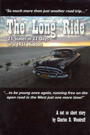
The Long RideI suppose non-roadies think we’re all alike. Normal people go to places and they do it in the most efficient manner possible. To them, folks who mutter stuff like “The journey is the destination” more than once every decade or so, just aren’t normal and should probably be avoided. They’re right, of course, but there is variety in our abnormalities.
Charles B. Woodruff, author of The Long Ride: 23 states in 22 days in a 1951 Hudson qualifies as a roadie. He enjoys riding more than arriving and two lanes more that four and he knows about the Lincoln Highway and Route 66. He’d probably even enjoy following the Lincoln or Sixty-Six end to end but that’s not what floats his boat the highest. Following Route 66 in a rented Mustang wouldn’t interest him nearly as much as following some lesser road in a Hudson; Preferably the 1951 Super 6 he’s owned for nearly forty years.

The Long Ride recounts Woodruff’s drive from Schenectady, New York, to Spokane, Washington, and back again in that Hudson. It wasn’t his first road trip in the car or even his first long trip. By the time he pulled out of Schenectady and headed to the 2010 National Hudson Meet in Spokane, he and the car had already visited 43 of the contiguous United States together. By the time he returned, it was all 48.

The book is “Published by the author” so it’s not quite as polished as the latest Random House offering but neither is it particularly crude. Woodruff is a librarian in real life so he knows his way around books. I saw a few errors that a high priced copy editor might have squelched but there’s no guarantee of that. This is a very readable account of a quite interesting journey.

There are pictures, too, including a few black and white ones of his parents and a younger self. But most are in color and taken during the Long Ride with a digital camera purchased just days before departure to replace a 35mm stolen in November. Somewhere along the way, Woodruff admits that the thief may have actually done him a favor by forcing this bit of modernization on him. In the photos, the car is the star. It isn’t in every picture but it is in most. That is as it should be. The Hudson is shown at state lines and in front of houses. There’s a nice shot, taken from the board-walk fronting a Montana saloon, of it waiting patiently in an unpaved street. That saloon struck all the right chords with Woodruff and looked rather inviting to me, too. The cover shows the old car parked beside the Bonneville salt flats with a glorious day climbing over the horizon behind it.

Woodruff talks about the country he passes through and the gathering of Hudsons that is the reason, or more accurately the excuse, for the trip. He describes the friends that share portions of the Long Ride and places with family connections where he stops along the way. He talks a lot about the car and its history. What he doesn’t talk about is car trouble. I hope I’m not ruining too much suspense when I reveal that, except for a few instances of vapor lock, the fifty-nine year old performs admirably. Oil and brake fluid had to be replenished now and then and, more than once, Woodruff shares his concerns about the temperature gauge climbing when traffic or construction slowed forward progress and reduced airflow.

The trip is, in fact, so trouble free that I’ve almost forgotten just how big an undertaking it was until the epilogue reminds me. Woodruff had very few preparations planned for the car before taking off and real life circumstances prevented him from accomplishing even all of those. As I began the book and saw the old Hudson pulled almost directly from storage and pointed westward, I felt that a few hours stranded by the road were probably inevitable and a drive ending malfunction only slightly less likely. By the time the car and its driver cross back into New York, those concerns were pretty far in the background. They are recalled , however, when Woodruff talks of doing it “…on my terms or not at all.” Of not doing it “…in a modern car or even a Hudson that was in tiptop condition…” or “…in a caravan…”. Woodruff is writing about himself and his plans for the drive when, early in the book, he says “Crazy? Maybe.”

So what?

The Long Ride: 23 States in 22 Days in a 1951 Hudson, Charles B. Woodruff, Published by author, 2011, 9 x 6 inches, paperback, 191 pages.
Available from author:
Charles B. Woodruff
DoDDS-K, Unit 15549
Box 141
APO AP 96205
cbwoodruff@hotmail.com
Price $19

Book Review
Route 66 Sightings
Graham, McClanahan, & Ross

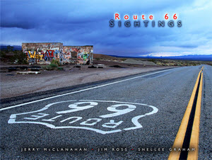
Route 66 Sightings coverI expected to be impressed by the images in Route 66 Sightings. They come from three of the best photographers ever to point a camera at Route 66. I didn’t expect to be educated though I now realize that I should have. Those three photographers, Shellee Graham, Jim Ross, and Jerry McClanahan, are also three of the most competent of Route 66 historians.

The first book I reviewed on this blog was a photographer-writer collaboration. That’s a fairly common arrangement. It’s not because the writer can’t take a decent photograph or because the photographer is illiterate or knows nothing about the subject.  It’s because one person typically produces better images while the other is the better word smith and/or more knowledgeable. The three people behind …Sightings are all quite adept at recording, remembering, and ‘riting.

Unlike many books connected with a road, the organization here is not geographic. No east to west or north to south. Instead, the photos are divided into categories. Roadside attractions and businesses that have completely vanished are pictured in a gallery (Yeah, it’s a lot like a chapter.) called “Gone”. Some that can still be visited, but just barely, appear in the “Used to Be” gallery. “Against the Odds” covers the rare business or attraction that continues being what it’s always been and “Rescued” covers those that live on by being something different. Roadside attractions with a recent beginning make up “New Kids on the Block”.

“Gone” is the first gallery and I believe it is my favorite. Of course, nothing in the gallery exists today. With very few exceptions, they were gone before I started paying attention to Route 66 in any meaningful way just shy of the turn of the century. So I get a glimpse of things that I’ll never see in the real world and that fact, no doubt, has a lot to do with the chapter being my favorite. Some of the subjects were still operating (Shawford Motel, Club cafe) or at least intact (Coral Court Motel) when photographed. Others (Conway Motor Court, Querino Canyon Trading Post) would be candidates for the “Used to Be” gallery if time hadn’t since obliterated them completely. I have to single out McClanahan’s picture of the Querino Canyon Trading Post, with the buckled building frozen in mid collapse, as a personal favorite.

By being first, the “Gone” gallery introduces the format for the book’s layout. It isn’t particularly rigid so maybe style is a better word than format. With but a few exceptions(3, I think) each spread (both verso and recto pages, and yes, I did have to look that up) is a set. There is one large photograph and two or three smaller ones. All are of varying sizes. They may or may not all be by the same photographer and may be of the same subject or merely related subjects. The accompanying text is written by the person who produced the set’s large image. It looks good and works well.

And the “Gone” gallery does one more thing. It bolsters the credentials of the authors. I’ll confess to not knowing exactly how long each of these writer-photographers has been cruising Route 66. I believe McClanahan has been doing it most of his life and I suspect that’s true, or close to it, for Graham and Ross, as well. Regardless of what the year counts are, the pictures in “Gone” show that these three were looking seriously at the road and the world around it long before most of us even got off of the expressway. The accompanying text is a combination of personal memories, learned history, and an occasional thimble full of roadside philosophy. You step out of the gallery feeling that, if they know that much about stuff you’ve never even heard of, they’re certainly qualified to write about anything the other galleries might hold.

“Used to Be” is filled with thought-provoking pictures of abandoned and deteriorating buildings. Two photos in particular grabbed my attention. Both are by Jim Ross as are the majority of photos in this section. The first is of the Painted Desert Trading Post. I’ve never been there but I’ve seen plenty of pictures. Most are close-ups that show the building and its hand painted signs. Ross has captured the view from some distance so that the actual trading post, on a fading gravel road surrounded by lots of nothing, takes up a very small portion of the photo. He tells us that this was an “opportunity to more fully portray the desolation of the site”. It does indeed.

The other “Used to Be” photo that tugged at my eye is of a place where I have been. I’ve visited John’s Modern cabins a couple of times and I’ve seen scads of photos. Ross sets his photo apart from most by filling the frame with the green of the shingles and the red and yellow of the faded sign backed by green leaves. The condition and, yes, the desolation, of John’s Modern Cabins may be more accurately shown in Jim’s wider and grayer and more typical shot on the opposite page but I like the green.

Because they are currently active, the subjects of “Against the Odds”, “Rescued”, and “New Kids on the Block” are likely more familiar to fans of the road than even those of “Used to Be”. Not only do they show up in trip reports and vacation albums, many are actively promoted and advertised. Of course, the trio behind Route 66 Sightings does not do normal even here. Shellee Graham puts owner Fran Houser’s autograph covered truck in the foreground of a Midpoint Cafe photo, Jerry McClanahan captures a restored 1956 Greyhound in front of the Munger Moss in 2010, Jim Ross shows us the Hackberry General Store with snow on the ground, and there are plenty more.

There is, in fact, a whole gallery I’ve not even spoken of. It shares its name with the book itself and is called simply “Sightings”. It’s potpourri; Really good potpourri. It contains photos that the authors liked well enough to include despite them not fitting in any of the planned galleries. How’s that for an endorsement?

The quality of the contents is pretty much matched by the quality of the book itself. The slick heavy pages reproduce the photos wonderfully. There’s little doubt that a picture’s colors appear just as the photographer intended even for the book’s handful of black and white images. It’s a beauty… and smart, too.

Route 66 Sightings, Jerry McClanahan – Jim Ross – Shellee Graham, Ghost Town Press, October 2011, 12.2 x 9.3 inches, 200 pages, ISBN 978-0967748184
Available through Amazon.

Book Review
Border to Border on US Route 89
James Cowlin

US-89-Photography-Guide-CoverWhen I first glanced at the title of James Cowlin’s latest ebook, I’m pretty sure I expected it to contain advice on exposure and filters and other photographic folderol. But a more thoughtful reading of the carefully constructed title yielded a different impression. Just as the title says, Border to Border on US Route 89; A photographer’s guide to America’s most scenic highway is not a guide to photography. It’s a guide to a highway.

It was written by a very accomplished photographer and other photographers, even some as good as Cowlin himself, can benefit from it. But, at its heart, the book is simply a guide to Cowlin’s beloved US 89 written — and illustrated — from a photographer’s point of view.

The book is organized around thirty photos taken in the spring of 2010 as the Cowlinses (Jim and wife Barbara) traveled the highway from Mexico to Canada. Each beautiful photograph is accompanied by a few lines of text which typically tell something about the subject as well as something about the photo. But that something about the photo is not F stops and focal lengths. It’s generally just Jim explaining what he saw and tried to capture.

The photos appear, each on its own page, in south to north sequence. Cowlin sees three geographic regions along the route and a couple of pages of description precede the photos from each region. These pages provide a little background, give some idea of what might be seen there, from the 58 kinds of reptiles and amphibians in southern Arizona to the glaciers at the Canadian border, and identify some favorite photo ops.

The book does not contain detailed instructions for driving the route or for duplicating the wonderful pictures. It does contain an excellent overview of the road that Cowlin calls “America’s most scenic Highway”. He lets slip the real purpose of the book in the forward when he says “I do hope that this guide will inspire you to take a road trip on US Route 89.” The book definitely contains a lot of inspiration.

James Cowlin is the founder of US Route 89 Appreciation Society. Border to Border on US Route 89; A photographer’s guide to America’s most scenic highway can be purchased here. A Road Trip Map Book is available here.


Deciding that book reviews were a good fit for this blog instantly put me way behind. If I posted them on Sundays when there was nothing more pressing it might take me months just to squeeze out the half-dozen or so already on the list. To keep that from happening, I’m going to post book reviews on Wednesdays for the next few weeks and leave Sundays for whatever.

Book Review
Ghost Towns of Route 66
Jim Hinckley

Last week’s visit to Fort Recovery was triggered by a book. That book, a new one on the 1791 Battle of the Wabash, was available (pre-release) and its author, in addition to autographing copies, gave a presentation on the battle. As I wrote the blog entry about the visit, I was simultaneously struck by the idea of reviewing the book and the realization that book reviews might make good subjects for blog entries. I’ve recently picked up a few new books including some by people I know and to whom I’ve promised some feedback. Reviews, it seemed to me, would be a good way to feed the blog and focus the feedback. So here is the first book review entry. I promise there will be more.

Ghost Towns of Route 66The subject of this review is a book I picked up from the author, Jim Hinckley, when I passed through Kingman, Arizona, in June. Ghost Towns of Route 66, is the second Hinckley product I’ve read. The first was Route 66 Backroadswhere I was at least as impressed with the photography as with the writing. That is true of the newer book as well. …Backroads used photos from Kerrick James and Rick & Nora Bowers along with some from outside sources. James is the only photographer listed on the cover of Ghost Towns… although there are a few by others including Hinckley. My praise for the photos is not intended to diminish Hinckley’s writing but to recognize some wonderful images and acknowledge a huge reason that these books get a second look when spotted on a store shelf or counter.

Ghost towns is a subject where photos and words can truly complement each other. By definition, a ghost town is a place that was once thriving but is no longer. When you visit a ghost town, you look at what remains and try to imagine what once was. James’ pictures let you see what remains and Hinckley’s words help you imagine what was there once upon a time.

Hinkley’s words are the result of some serious research. The man definitely does his home work. Facts about a town’s beginning are usually given and the events and circumstances leading to its rise and fall are discussed. Some of the falls are complete while others are far from it.

A few towns on Sixty-Six do match the far west ghost town image of complete  desolation with nothing moving but tumble weeds. Those that do, like Allanreed in Texas, Endee in New Mexico, and Glen Rio on the state line between them, tend to be a bit to the west themselves. Other towns that Hinckley has included, such as Galena in Kansas and Afton in Oklahoma, ain’t dead yet.

In fact, Galena and Afton are current must-stops on any Route 66 trip through the area. In Galena, 4 Women on the Route has become a major roadside attraction in just a few years and in Afton, Laurel Kane’s Afton Station, established a bit ahead of 4 Women…, is a true Route 66 icon. But Hinckley isn’t to be faulted for including these towns. Both are mere shadows of their boom time selves. The decline has currently ceased and maybe even reversed but there was sure a lot of it and there is no guarantee that it isn’t just paused.

This isn’t the first book one should acquire when planning a drive down Historic Route 66. In my opinion, that spot belongs to Jerry McClanahan’s EZ 66 Guide and there are other route related books offering a broader view of the road and the attractions at its side. But, if you are attracted to clusters of dilapidated buildings and often wonder what a wide spot in the road used to be, Ghost Towns of Route 66 could be just the book you want. You’ll get lots of history and some great photos of many un- and under-populated
settlements along the historic highway.

Ghost Towns of Route 66, Jim Hinckley and Kerrick James, Voyageur Press, June 2011, 10.25 x 8.75 inches, 160 pages, ISBN 978-0760338438
Available through Amazon.


Viva la Mush or rebellion in the heartland. I like fried mush. It reminds me of my childhood. The fact that Bob Evans restaurants served this breakfast staple accounted for many — perhaps even most — of my visits there. Last month, when my local Bob Evans informed me that mush was no longer available, I was heartbroken. When this came up in a conversation with my sister, she told me that, although it was no longer on the menu, fried mush could still be had at the Bob Evans in Greenville, Ohio, if you asked. I stopped in to make sure she wasn’t just teasing me and found that, not only was it available, it had been returned to the menu. I told the cashier how I had been forced to come there because my own Bob Evans had dropped my favorite and she told me they had tried that, too, “but it didn’t go over very well.” After a week or two mush was returned and it reappeared on the menu at the next printing. Viva la mush and viva the small town restaurant manager who keeps her customers happy in spite of corporate directives.